2019 New Jersey Research Trip: Newark

The New Jersey Historical Society in Newark holds the trial notes for an ongoing New Jersey court case that started in 1844 that may involve this researcher’s ancestors. Time for a research trip.

Dawn at the New Jersey Historical Society in Newark, New JerseyFacade of New Jersey Historical Society, 2019
New Jersey Historical Society, 2019.

I have been researching my New Jersey Carson family origins as best as I can from my home in the Pacific Northwest, in earnest, for two decades or more. I had vague hopes of visiting New Jersey to do on-site research for years, but no firm plans. This was the year that everything came together for me, and I was finally able to put my loafers on the ground in a two-part research trip to Newark and Trenton. I planned to visit libraries, archives, and graveyards and otherwise explore the area that my maternal ancestors once called home.

The first part of my trip centered on a visit to the New Jersey Historical Society in Newark. A friend and I flew cross-country to Newark, touching down on a Tuesday afternoon. We spent the remainder of the day getting our bearings and found that the historical society was housed in a lovely old building once known as The Essex Club. The next day, theater tickets in hand, we took the train into NYC for a wonderful matinee production of Hadestown, and dinner at Sardi’s. It was then back to our hotel before nightfall to further prepare. We chose to stay at TRYP by Wyndham, because of its proximity to the New Jersey Historical Society, which was just a short walk around the corner. A Starbucks is located conveniently across the park, too, as well as a Whole Foods.

The research objective that caused me to travel more than 2,400 miles was a case file within the manuscript collection of the Peter D. Vroom (1791-1873) papers. Vroom was a U.S. Congressman and Governor of New Jersey. He also was the attorney who represented a client named Daniel Carson in an 1844 lawsuit (Daniel Carson v. Aaron Eldridge). I have long been interested in New Jersey men named Daniel Carson; John Wesley Carson (1846-1925), eldest son of my 3rd-great-grandfather Charles Carson (1824-1863) stated in a Civil War pension deposition that his grandfather was named Daniel Carson.1 It is the only clue we have as to the origins of the parents of Charles Carson. He offered no proof and did not elaborate in any way. He made no mention of his paternal grandmother.

Since my research to date had only uncovered two men named Daniel Carson of the correct age and roughly the right place in New Jersey to have potentially been the father of Charles, this was a lead that in my mind had to be followed up on as part of a reasonably exhaustive research plan. Recall that reasonably exhaustive research is the first tenet of the Genealogical Proof Standard.2

This case had been on my radar ever since I had first run across an entry on noted New Jersey author Richard S. Hutchinson’s website in 2004. His website is now offline, but at one time said this in regards to the land and property of Abraham Rogers: “The estate, which ought to have been considerable, was chiefly absorbed in a lawsuit between Aaron Eldridge and Daniel Carson, claiming under different wills, which suit Carson eventually won.”3

In 2010, I learned papers from the trial were held at the New Jersey Historical Society, and I reached out to them several times through email as I recall. When my inquiries went unanswered, I hired a New Jersey genealogist the following year to see if a local contact could make any inroads. The local researcher was successful, and she ultimately visited the library on my behalf to examine the case file. Mostly, I wanted to know whether the file warranted a trip by me. Yes, she said, as it contained hundreds of pages and had testimony from numerous parties, including information about various relations among the parties to Abraham Rogers, and to each of the claimants.4 No photographs or photocopies were permitted back then, so the genealogist was forced to review the file and make notes that she thought could be relevant. In her limited time with the file, she found no mention of my ancestor, Charles Carson, but did make note of several clues about another child of Daniel Carson. My curiosity was piqued, and I resolved to visit at a future date.

That date finally arrived on a sunny Thursday morning in September 2019. I had an appointment, set up by emailing the library about a month in advance. I was most eager to get started with my research but library hours were limited to 12pm-5pm. We were able to have a leisurely coffee break while we waited for the library to open. After registering and paying the daily $5.00 non-member fee, we locked our backpacks in the lockers downstairs and took the elevator up to the fifth floor with our laptops, where we were enthusiastically greeted by James Amemasor, the Library Research Specialist. He quickly pulled the box containing the case file so I was able to get to work after a brief orientation. The small library contains both open stacks and an archive, but sadly, no guest wireless access. Fortunately, cell phones are permitted, so I was able to use that to set up a hotspot to access my files and Evernote.

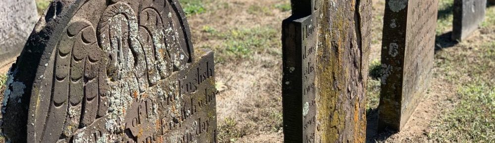
Unlike some other repositories I have visited, this private facility has a restrictive policy on taking photographs of items in their collection. However, it should be stated this policy has thankfully evolved in the past few years to permit at least some photos. Whether an image from a collection is permitted at all and how many images from the collection are allowed appears to me to be at the discretion of the Executive Director, Steve Tettamanti. He graciously allowed me to photograph about a dozen images for my personal use only from the case file. He completed a permission form for each request which we both signed off on. A large watermark was placed over each page, and I was allowed to take a snapshot with my cell phone. A donation of $1.00 per page was suggested. Because of the agreement I signed, I am unable to illustrate any of my findings on this blog, although a few general images that do not reveal specific content were permitted without the above conditions.

We spent three days at the New Jersey Historical Society in all, roughly 15 hours of research time. It may sound like a lot, but I know I barely scratched the surface of what this research library has to offer. Having a few digital photographs of the attorney’s notes was invaluable. I was able to go back to my hotel room in the evenings, and become familiar with the handwriting, which was very difficult to read and transcribe, even for someone experienced in using historical documents from this time period.  Literally, with about 20 minutes to spare, I found a mention of a previously unknown relationship that could break this line open. I remain guardedly optimistic that in the future I will be able to get a complete digital copy of the file that may further illuminate the relationships of the people in this community in the early 1840s.

I will cut to the chase here and not leave my readers in suspense. There was not a single mention among the many pages that I read of my ancestor, Charles Carson. Nothing. Perhaps it’s there and I just need more time with the file. Sometimes genealogy research is like that. I now need to move on and consider other hypotheses for the parents of my 3rd great-grandfather, Charles Carson.


Sources

1 Deposition of Claimant, 20 Apr 1921, John W. Carson (Pvt., Co. K, 35th N. J. Inf., Civil War), pension no. S.C. 218,816 (invalid), Case Files of Approved Pension Applications…, 1861-1934; Civil War and Later Pension Files; Record Group 15: Records of the Department of Veterans Affairs; National Archives, Washington, D.C.

2 Genealogical Proof Standard, Board for Certification of Genealogists (https://bcgcertification.org/ethics-standards/ : accessed 30 Nov 2019).

3 Charles Robbins Hutchinson with additions by Richard S. Hutchinson, “John and Elizabeth (Pearson) Hutchinson Line,”  The Website of Richard S. Hutchinson, (http://www.richardshutchinson.com/JohnHutchinsonPearson.htm : accessed 29 Nov 2004).

4 Elizabeth Pellicane, New Jersey [(email address for personal use),] to Dawn Bingaman, email, 30 Jul 2011, “Transcription and notes”; personal papers privately held by Bingaman, Washington.

DeedMapper Deed Entry Form

How to force the DeedMapper software program to display the Deed Entry Form every time a new deed is entered.

I received and installed the DeedMapper 4.2 upgrade about two weeks ago and immediately wanted to get started platting some of the 19th century New Jersey deeds that I have transcribed this year. Problem is, when I launched the program, I did not know where to start. I expected the Deed Entry Form to open when I opened a new deed, but it did not. All I saw was a vast empty screen:

deedmapper-main-windowThe DeedMapper Plot View screen

Here is how to activate the Deed Entry Form:

deedmapper-edit-deed-button

In the Plot View window, click the Edit Deed button shown above, just to the left of the Annotate button (the one that looks like a T). The Edit Deed button also appears on the Table View window.

deedmapper deed entry form
The DeedMapper Deed Entry Form simplifies deed data entry but is not enabled by default.

The Deed Entry Form was one of the enhancements in version 4 of the software that simplifies data entry but is not enabled by default. To force the program to open the Deed Entry Form every time a new deed file is started go to View > Options  and select the Text View tab. Under New deed entry on the left, click the radio button to select Deed entry form. The next time you open the program the Deed Entry Form will display automatically.

deedmapper view options window

I have used my new DeedMapper software upgrade to successfully plat three metes and bounds style surveys of land that I believe are relevant to my early Carson family research in Mercer County, New Jersey. The next order of business is to actually place these plat drawings on a contemporary New Jersey map. I have consulted a gazetteer to hone in on what hamlet or township various features described in deeds were located in to track down the proper maps.

deedmapper data entry form with first call
The land described in this 1842 deed from Abraham Rogers and wife to Aaron Eldredge was acquired by Daniel Carson just a few years later. The data entry form above shows the first call in the survey.

Carefully reading, transcribing and platting deeds surveyed using metes and bounds methods will reveal relationships and neighbors, and is a useful exercise in your genealogy research.

From Deed to Plat Map, Part 2

Creating a Plat Map from a Metes and Bounds Land Description: A New Jersey Example. Part 2 demonstrates the platting of a parcel using a free online tool

In part one of this two-part post, I created a call list, a stripped down extract of the lines in the 1847 deed that includes the compass points and distance. Armed with this information, I can begin drawing my land plat.

Although I own a copy of Deed Mapper by DirectLine Software, it was installed on my old desktop computer in another room in the home. I vaguely recalled that I had not yet installed the newer version, and didn’t know where the media was to install it on my laptop. So I decided to do an online search for other platting options. That is when I discovered Deed Platter. I am not sure how I overlooked this tool previously – it appears that it was released in 2004.

genealogytools-dot-net-website-deed-platterDeed Platter is a free utility available at the GenealogyTools.net website

Here is a portion of the Hammell to Carson deed with the first two line calls indicated.1847-hammell-to-carson-first-two-calls-indicated

Line call 1 reads: “…South twenty degrees East twenty nine chains and eighty three links…”
Line call 2 reads: “…South fifty four degrees and a half west ten chains and ten links…”

This information is highlighted in my line call worksheet, created in Microsoft Excel.

line-calls-hammell-carson-first-two-highlighted

The highlighted information from my call worksheet is shown in the Deed Platter form. The direction column in my worksheet needs to be broken down into three parts in order to be input into the form: direction, degrees and bearing.

deed-platter-data-entry-form-first-2-line-calls

Deed Platter shows the distance in poles by default. By using the drop down arrow, you can choose from a variety of distance measures, including rods, perches, arpents and Spanish varas. Fill in the bottom portion of the form to have that information included in your map (i.e. grantor, grantee, township, county, state and deed citation information).

This is what the first two calls look like platted using the Deed Platter software.

deed-platter-plat-map-of-first-two-line-calls

This plat map is far from complete but I wanted to demonstrate the process and not just the end result. Continuing working through the line calls, I end up with a Deed Platter table that looks like this:

genealogy-tools-deed-platter-9-calls-in-table

When I finished recording all the line calls from my worksheet into the Deed Platter table, I clicked the Plat Deed button to get a final plat map of the 1847 land purchased by Daniel Carson in East Windsor Twp., Mercer Co., New Jersey.

hammell-to-carson-1847-deed-plat-map

There is an additional table of information that can only be seen once the deed is platted that allows you to include markers and neighbors. I was unable to find a way to get that information to then be displayed on my map, though.

deed-platter-markers-neighbors-table

Markers and neighbors input into the table below the map are not displayed on the map itself. Click on image to enlarge.

Deed Platter is a great, free utility to plat a single parcel of land, but it is not without its shortcomings. Output capabilities appear to be limited to Save or Print, but may depend on which browser is used. With the Google Chrome browser, I was finally able to Print to a PDF file.

The real value in land platting is to place that land parcel somewhere on the globe, and to plat the entire neighborhood (some of whom may be kin), neither of which can be done with this software. I did not see any option to export my plat map for use in another mapping program.

Seeing the land platted definitely helps visualize a complex land description that otherwise just seems like an abstract concept. The Deed Platter software will certainly help you do that.

In summary, successful land platting is comprised of four steps, demonstrated in my two-part post.

1. Acquire a copy of the complete deed whenever possible
2. Transcribe the deed, making a full and complete copy
3. Extract the land description into a separate document that can be marked up
4. Plat the deed using platting software or by hand using paper, pencil and a protractor

If you think you’d rather tackle mapping manually, I can recommend several offline resources: Land & Property Research in the United States by E. Wade Hone (chapter 7) or How to Plot Land Surveys by Neal Otto Hively.

From Deed to Plat Map, Part 1

Creating a Plat Map from a Metes and Bounds Land Description: A New Jersey Example.

Part 1 demonstrates the preparatory work involved prior to the actual drawing of the plat map.

LAND. It was the opportunity to own land that led many of our ancestors to cross the ocean to America and, in some cases, traverse the continent. Since land was of vital importance to our ancestors, it should be equally important to genealogists wanting to form a more complete picture of their ancestors’ lives.

Even with the large numbers of original documents now online, deeds for New Jersey are not yet among them. So, I traveled to the Family History Library in Salt Lake City, Utah last fall where I spent three days reading microfilm and creating digital copies of deeds involving my Carson family and their associates who lived near Trenton, the state capitol of New Jersey.

One of the deeds I examined was an 1847 Sheriff’s Deed of two parcels confiscated by Mercer County Sheriff John Hammell to satisfy a judgment returned by the State Supreme Court of New Jersey against Aaron Eldridge in favor of Daniel Carson. The lands were formerly owned and occupied by Abraham Rogers, deceased.

hammell-to-carson-nj-deed-1847
Portion of a deed between John Hammell, Sheriff of Mercer County, New Jersey to Daniel Carson of East Windsor Township. (Click this or any other image to enlarge.)

I transcribed this deed using my word processing software. Recall that a transcription
is “an exact copy”. [1] To fully analyze a record, we must spend some time with it. For me, the process of converting handwritten records into documents in my word processor facilitates both my understanding of the record and later recall of that record. Transcribing a record also allows me to search my digital files and retrieve the transcribed text for later use in research reports and the like.

hammell-to-carson-deed-transcription
Portion of my transcription of the 1847 deed. I capitalized the names of the parties mentioned within the body of the transcription for easier identification.

The complete metes and bounds description of this land from this deed is as follows:

“…Beginning at a stone standing in the middle of the road leading from Cross Keys to the Assunpink Bridge being a corner to George Newell’s lot thence along the middle of the road according to the bearing of the compass in the year of our Lord eighteen hundred and thirty two South twenty degrees East twenty nine chains and eighty three links to the corner of John H Hutchinsons land thence along his line South fifty four degrees and a half west ten chains and ten links to a stone corner to the Heirs of Amos Rogers deceased thence along their line North forty seven degrees and three quarters West twenty one chains to a stone in a pond thence north seventy three degrees West nine chains and forty one links to a stone thence north thirty six degrees and a half West eight chains and thirteen links to a stone thence north fourteen degrees and a quarter West four chains and forty one links to Augustus Gordons line in the middle of the road leading from Assunpink Bridge to nottingham Square thence along said line and road north seventy three ^ degrees and three quarters East twenty three chains and ninety seven links to the corner of the aforesaid George Newell’s lot thence along his line South twenty degrees East two chains and two links thence north seventy three degrees and three quarters East five chains to the Beginning containing seventy acres be the same more or less…”

The key to working with survey descriptions like the above is to separate out the calls into corners and lines. Patricia Law Hatcher describes one such method in her book entitled “Locating Your Roots: Discover Your Ancestors Using Land Records” (Cincinnati, Ohio: Betterway Books, 2003) : 140-142 that I have successfully used, and will show here today. A line will include both a direction and a distance and a corner is where two survey lines meet, usually delineated by a naturally occurring landmark, such as a stone or a tree. A metes and bounds survey normally will start with a corner and subsequent calls will alternate between lines and corners.

Take the first part of this survey as an example:

Corner
Includes landmark
…Beginning at a stone standing in the middle of the road leading from Cross Keys to the Assunpink Bridge being a corner to George Newell’s lot
Line
Includes direction and distance
thence along the middle of the road according to the bearing of the compass in the year of our Lord eighteen hundred and thirty two South twenty degrees East twenty nine chains and eighty three links

Working through the calls in the deed, and following Hatcher’s method of visually notating the corners and lines with different symbols, my extracted information looks like this in part:

hamell-to-carson-hatcher-example-cropCorners and lines in the survey description have been separated out as an aid in later platting of the land

I marked the corners with the copyright symbol and used an arrow bullet for the lines, but copyright-arrowyou can use anything that helps you to visually separate the information.


The ultimate goal of this exercise is to get a complete description of the land. You don’t want to miss a call and end up with an incorrect plat map. Using Hatcher’s method will minimize the chances of that happening. My deed transcription and later extract of the land description can be further distilled into the essential elements for the actual platting: the boundary line calls.

line-calls-hammell-to-carson-1847
A line call in a survey typically includes both a direction and a distance. A chain is a unit of measurement equal to 66 feet. There are 100 links in a chain. [2]

Now that I have a complete description of the boundaries of the land purchased by Daniel Carson, I can begin to actually map, or plat, the land. I will demonstrate that process in my next post using a freely available online tool.

Sources:

[1] Elizabeth Shown Mills, “Skillbuilding: Transcribing Source Material”, OnBoard 2 (January 1996): 8; Board for Certification of Genealogists (http://bcgcertification.org/skillbuilders/skbld961.html : accessed 16 Jul 2015).

[2] See image of a Gunter’s surveying chain and description at Wikipedia, “Gunter’s chain,” Wikipedia, The Free Encyclopedia, (https://en.wikipedia.org/w/index.php?title=Gunter%27s_chain&oldid=652072667 : accessed 16 Jul 2015).